What to know before Oahu flood map changes take effect June 10
HONOLULU (HawaiiNewsNow) – New federal flood insurance rate maps (FIRMs) for Oahu take effect next week.
Read more Maui blind kite flier aims to inspire others
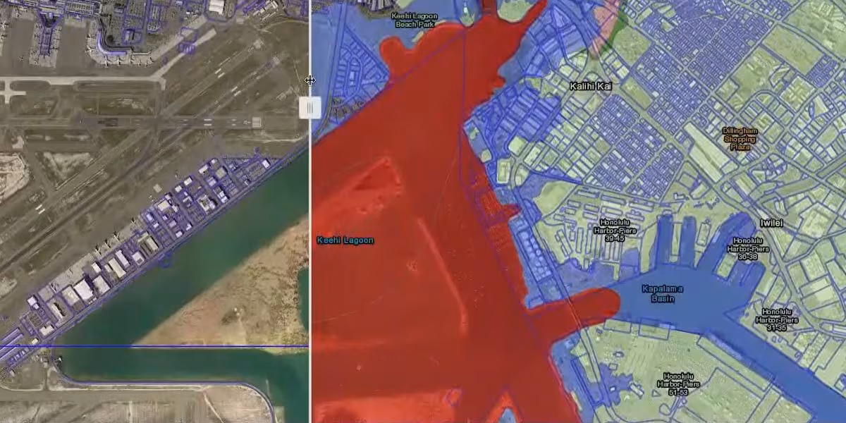
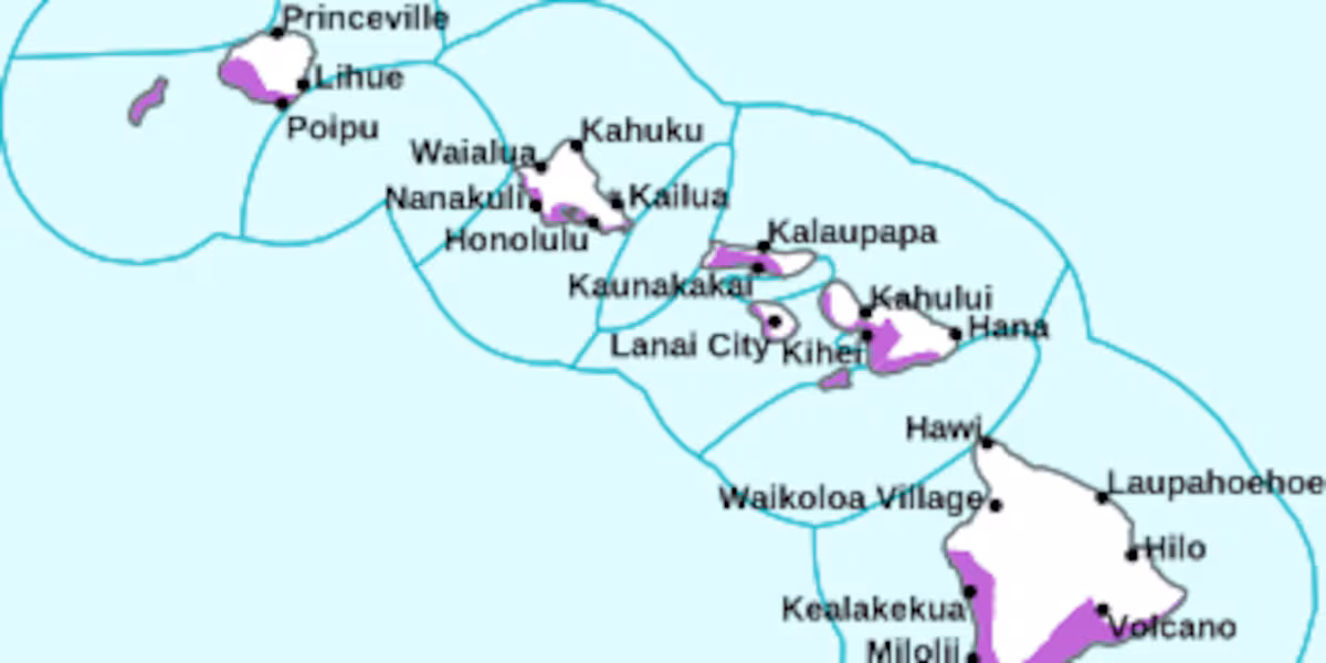
The new maps are the first major island-wide remapping of Oʻahu in more than 10 years, and approximately 250,000 properties were reviewed as part of the remap.
The updated FIRMs go into effect June 10, along with all regulatory and flood insurance requirements.
More than 8,000 properties were described as moving from X or D zones into higher-risk A or V zones, while less than 400 were described as moving into lower risk zones.
Homeowners that were moved into higher risk special hazard zones may now be required to carry flood insurance.
LEARN MORE: More homeowners face mandatory flood insurance, optional coverage available
Atlas Insurance employees Shane Choi and Sean Satterfield explain new insurance updates to the public in their Risky Business Podcast. In their latest episode, they focus on explaining the implications of the flood zone remapping.
The episode explains that everyone is in a flood zone, whether that be a high risk or low risk one. The reality of being on an tropical island means that flooding can occur anywhere.
Read more First Alert Forecast: Tracking gusty trades this weekend and a series of swells; rough seas
Episode guest Maile Fuchshuber, a senior flood insurance underwriter from First Insurance Company of Hawaii, said:
“Many people assume that if they are in an X zone, they are not in a flood zone at all, but that is not the case. Everyone is in a flood zone—the real issue is the level of risk.
With the Oʻahu remapping taking effect on June 10, it is important for property owners, boards, and mortgage holders to understand how their designation may be changing and what that could mean for their flood insurance requirements.”
A notification of any required changes should be on the way from your lender within 45 days of the map change.
The Federal Emergency Management Agency (FEMA) works with communities across the country to identify flood hazards and promote ways to reduce impacts and risks.
Officials say the updated maps provide critical new insights into evolving flood risk across the island.
Read more State declares traffic emergency zone on Daniel K. Inouye Hwy. after fatal crashes


Post Comment