First Alert Forecast: Lighter trades, big south shore surf for Sunday
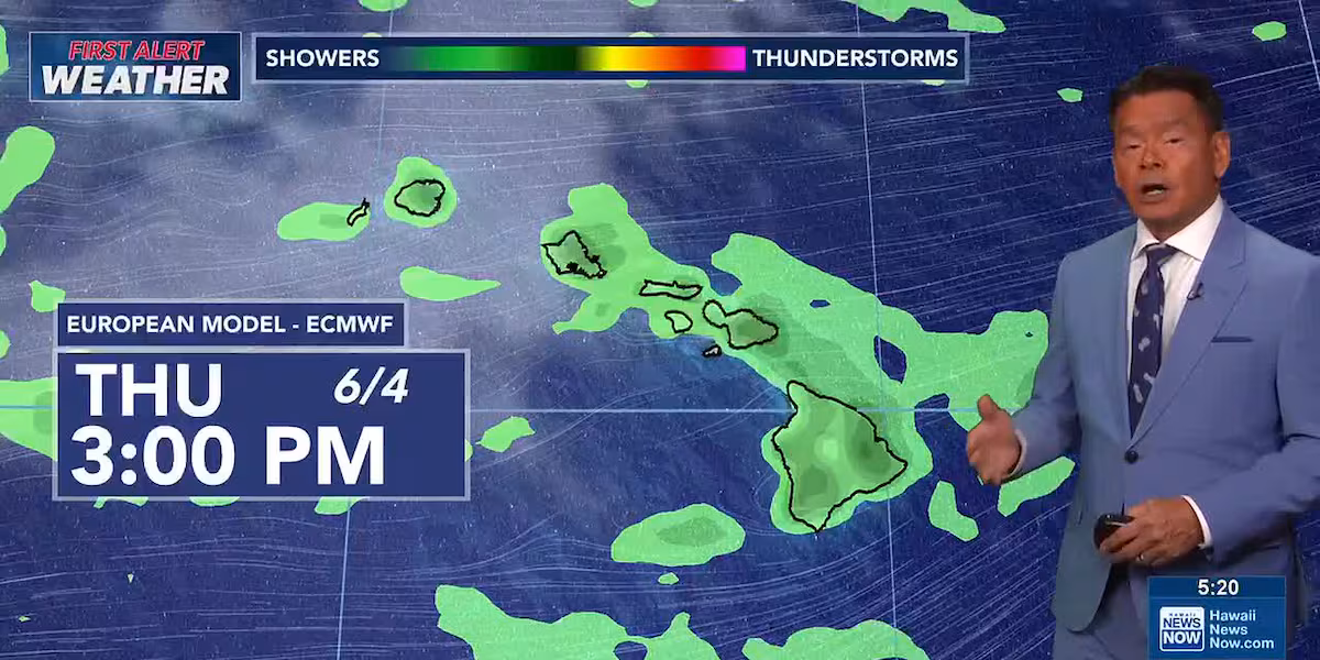
HONOLULU (HawaiiNewsNow) – Trade winds are forecast to ease up slightly as we begin the new week. The chance for showers will increase briefly Tuesday through Wednesday as an area of tropical moisture moves over the islands, but no heavy downpours are expected.
The big story in the coming week is high surf on south shores. A high surf advisory remains posted until 6 p.m. Sunday for all south-facing shores. West shores will also see some elevated wave heights from the south-southwest swell wrap. Surf on north and east shores will be small.
There’s a First Alert for new advisory-level swells expected again late Monday into Tuesday.
Hurricane season begins Monday in the central North Pacific. We’re already also tracking an area far to the east of the islands that has an 80 percent chance of developing into a tropical cyclone in the next seven days, but the forecast calls for it to dissipate before it even enters the central Pacific. We’ll keep an eye on it for you and have your First Alert if anything changes.
View the latest weather conditions here.
Download the HNN Weather app from the Apple App Store or Google Play for the latest updates from your First Alert Weather Team: chief meteorologist Jennifer Robbins, meteorologist Drew Davis, and weather anchors Guy Hagi, Ben Gutierrez, and Billy V.


Post Comment