First Alert Forecast: Weekend calls for warm and slightly humid days plus a large south swell
HONOLULU (HawaiiNewsNow) – Happy Aloha Friday! Getting ready for a big swell. No alerts today, but quickly ramping up tomorrow until end of the weekend!
Read more Rising Maui surfer Jackson Bunch rides setbacks into victories
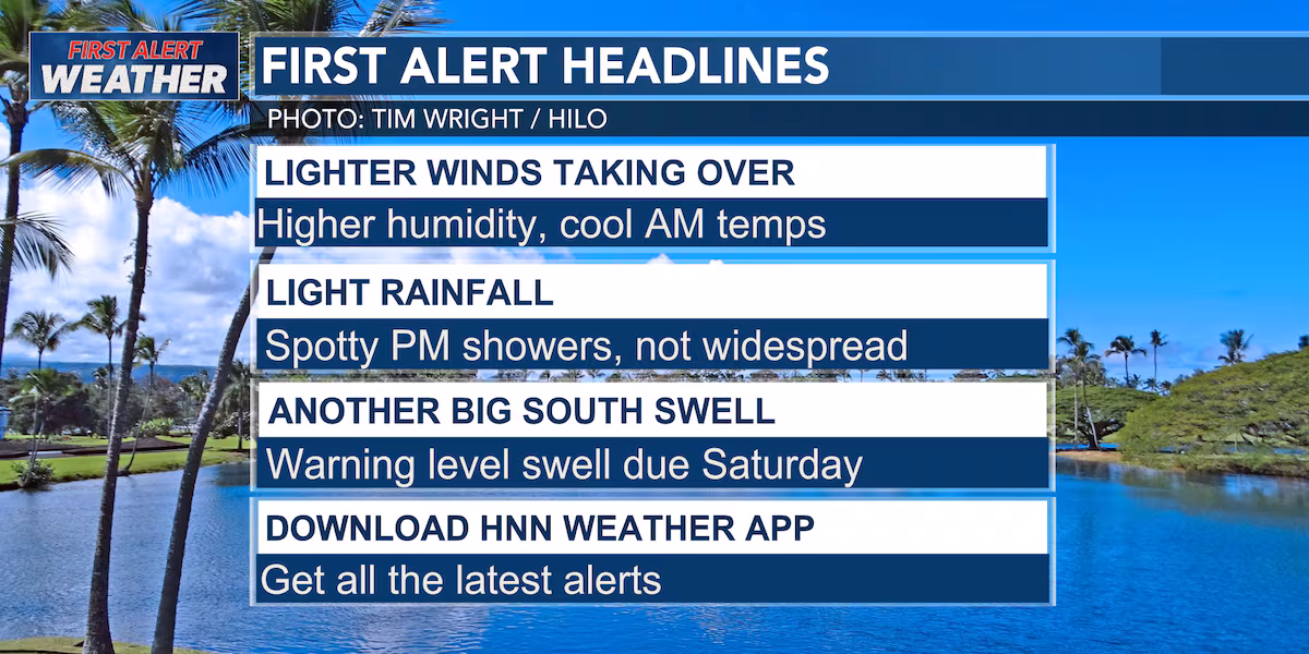
The islands are settling into a quieter weather pattern for the weekend as trade winds ease, allowing local sea breezes to take over during the afternoons. That means a mix of sunshine and clouds each morning, followed by a few interior and leeward showers developing during the afternoon and early evening hours, especially on Saturday. Windward and mauka communities will still see their usual passing showers, but widespread rainfall is not expected.
By Sunday, trade winds will begin strengthening again and continue to increase into next week. As those trades return, Hawaii’s weather will shift back to a more familiar pattern, with clouds and showers favoring windward and mauka areas while leeward locations enjoy longer periods of sunshine. Forecast models are also hinting at a pocket of deeper tropical moisture arriving late Sunday into next week, which could boost shower coverage, though there is still some uncertainty regarding how much moisture reaches the islands and how long it remains nearby.
For weekend plans, Saturday looks warm and pleasant overall but keep an eye on afternoon clouds and a few localized showers if you’re heading inland or to leeward areas. Sunday starts similarly, though breezier conditions will gradually return as the day goes on. Outdoor activities, graduations, beach days, and Father’s Day celebrations should see generally favorable weather with only brief passing showers.
Read more ‘Heartbroken’: Ward Centre prepares to close after more than four decades
Beachgoers should pay close attention to the surf forecast. A large, long-period south swell generated near New Zealand is expected to arrive this weekend, with surf building Saturday afternoon and peaking Sunday into Monday. South-facing shores could see surf reach high-end advisory levels and possibly approach warning levels. The swell will coincide with higher-than-normal afternoon tides, raising the potential for significant wave run-up and minor coastal flooding in vulnerable shoreline areas early next week. East shore surf will remain below average through the weekend due to lighter trades, while north shore surf stays tiny with only a small bump possible early next week.
Overall, Hawaii’s weekend weather looks fairly typical for June: warm days, light winds, a few afternoon clouds and showers, and increasingly impressive surf along south-facing beaches heading into next week.
View the latest weather conditions here.
Download the HNN Weather app from the Apple App Store or Google Play for the latest updates from your First Alert Weather Team: chief meteorologist Jennifer Robbins, meteorologist Drew Davis, and weather anchors Guy Hagi, Ben Gutierrez, and Billy V.
Read more Oahu farmers seek help, as city officials discuss future of Office of Economic Revitalization


Post Comment