First Alert Forecast: Fausto Staying North
HONOLULU (HawaiiNewsNow) – Tropical Storm Fausto continues to weaken as it passes well north of the Hawaiian Islands. At 5 pm Hawaii time the center was about 255 miles north/northeast of Hilo and 350 miles east-northeast of Honolulu, with maximum sustained winds of 40 mph. The good news is that Hawaii is not expecting direct tropical storm impacts.
Read more Blessing held for Koa Vista II affordable housing project
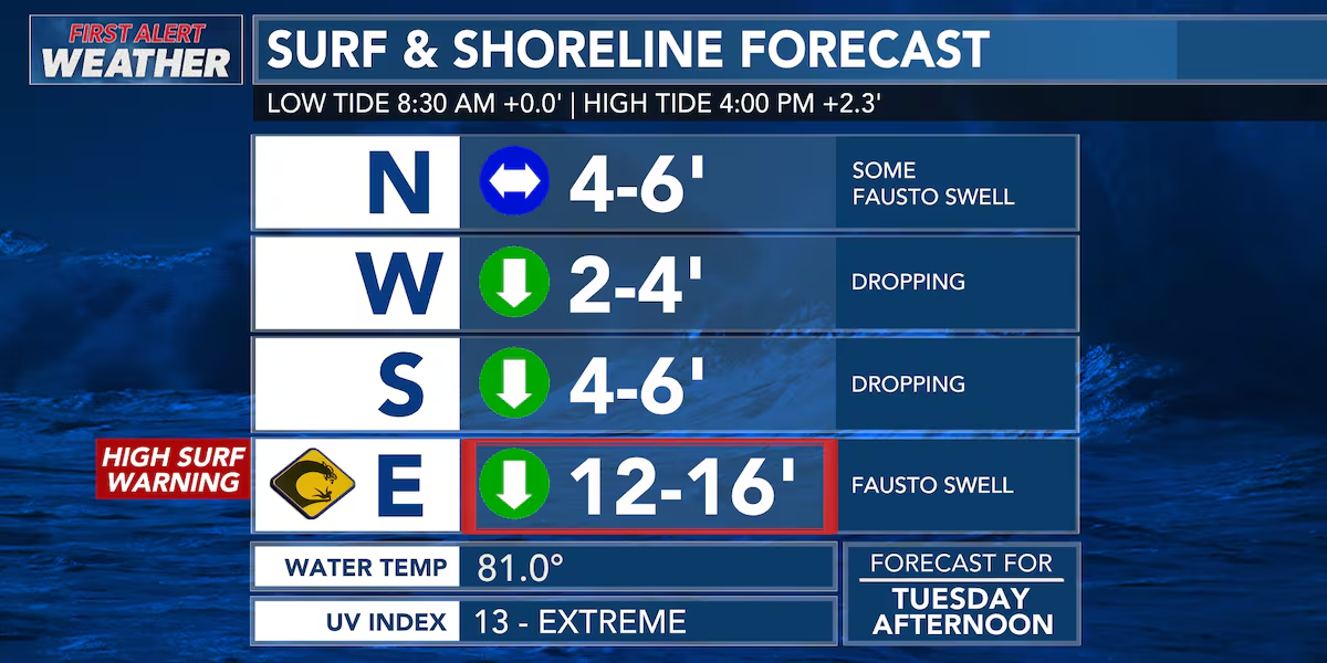
The biggest story is the surf. Even though Fausto is weakening and staying north of the state, it’s close enough to send a powerful east swell our way. East-facing shores are seeing dangerous surf, strong currents, and rough ocean conditions, with the largest waves peaking today into Wednesday. A High Surf Warning remains in effect through Wednesday afternoon.
And we’re not done yet. As Fausto moves away and fades, Hurricane Genevieve is expected to send another long-period east swell toward Hawaii later this week into the weekend. That means east shore surf is expected to build again after a brief drop, keeping hazardous ocean conditions in place for several more days.
Read more L&L to give away free Spam musubi on Aug. 8
The First Alert Weather Team will continue tracking both systems and keep you updated.
View the latest weather conditions here.
Download the HNN Weather app from the Apple App Store or Google Play for the latest updates from your First Alert Weather Team: chief meteorologist Jennifer Robbins, meteorologist Drew Davis, and weather anchors Guy Hagi, Ben Gutierrez, and Billy V.
Read more DHHL responds to lawsuit over evictions of non-Native Hawaiians






Post Comment