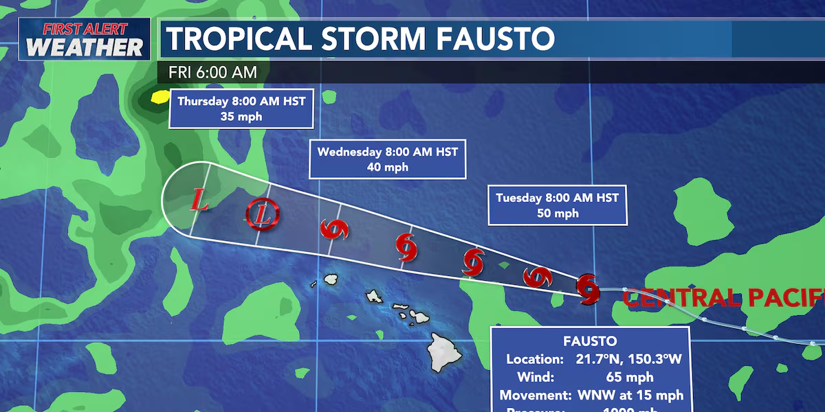
First Alert Forecast: Fausto to pass to the north of Hawaii
HONOLULU (HawaiiNewsNow) – Good Tuesday morning! Fausto’s demise, as forecasted, has begun. The system has now weakened into a tropical storm and will remain to the north of the island chain. The storm’s closest approach will occur throughout Tuesday evening into Wednesday.
Read more First Alert Forecast: Fausto Weakens to Tropical Storm
The wind threat from this storm remains low. The strongest winds from Fausto will remain well to the north of the state.
Expect a change in the winds, however. Breezy north/northeasterly winds are expected on Tuesday as the storm passes to the north. Expect trade winds to halt on Wednesday, creating rather muggy conditions across the state.
We can also expect a slight uptick in showers throughout Tuesday and Wednesday, potentially even some heavy showers. The lack of winds on Wednesday could allow for a few heavy sea breeze showers to develop, but I expect these to remain scattered.
Fausto will make its closest approach to Kauai and Oahu Tuesday evening into Wednesday. For right now, widespread flooding is not expected.
Read more Hokulea original crew reunites for 50th anniversary of maiden voyage to Tahiti
Surf remains the largest impact we’ll experience from Fausto. A HIGH SURF WARNING is now in effect for all east-facing shores until 6 p.m. Wednesday.
Large breaking waves between 10-14 feet are possible. We will be monitoring east-facing low-lying areas for coastal flooding over the next several days.
As always, we’ll update you if any of the data changes over the next several days.
View the latest weather conditions here.
Download the HNN Weather app from the Apple App Store or Google Play for the latest updates from your First Alert Weather Team: chief meteorologist Jennifer Robbins, meteorologist Drew Davis, and weather anchors Guy Hagi, Ben Gutierrez, and Billy V.






Post Comment