First Alert Forecast: Tracking Fausto’s impacts ahead of its passage to our north
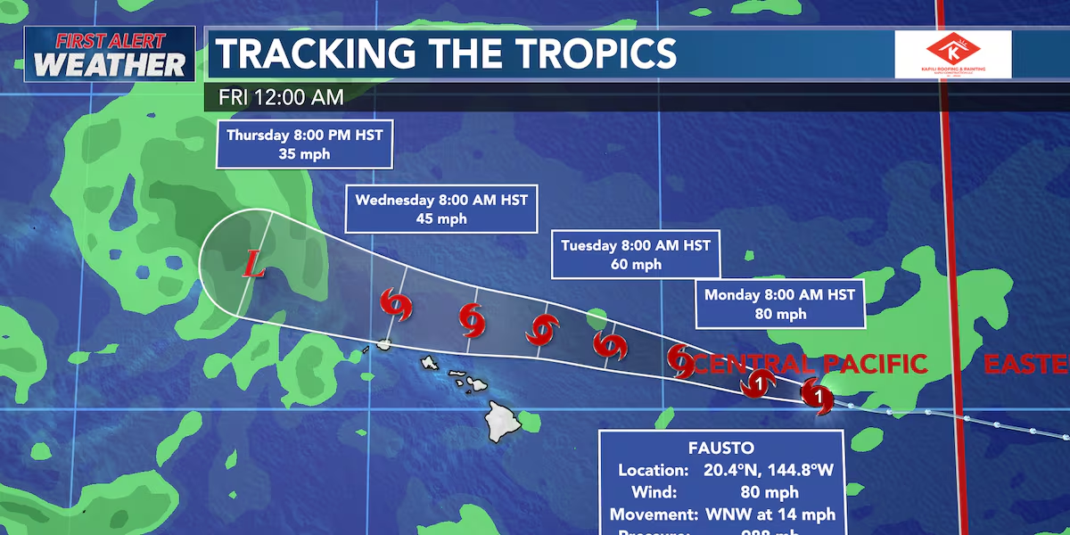
HONOLULU (HawaiiNewsNow) – Hurricane Fausto has been the main weather story for about a week now, and we continue to monitor its close passage to the north of the state. Fausto’s closest approach will occur between Tuesday and Wednesday.
Read more Former Oahu resident describes Seattle shooting: ‘I’ve never been so scared’
The storm will also weaken quickly as it moves to the north of the islands.
Latest model guidance continues to place Fausto’s track to the north of the island chain, meaning the wind threat from this storm remains low. The strongest winds from Fausto will remain to the north of the state.
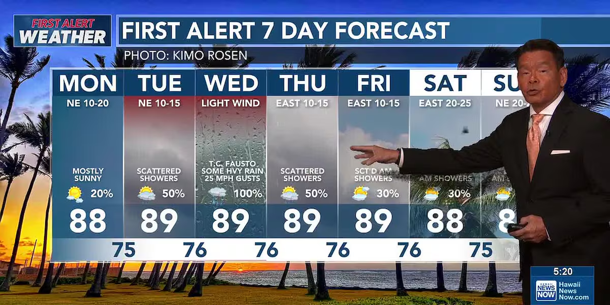
Fausto will impact our winds, however. Expect trade winds to halt Tuesday into Wednesday, creating rather muggy conditions across the state.
Scattered showers and pockets of heavy rainfall are expected as Fausto makes its closest approach. The bulk of the chance for heavy rainfall currently looks to be on Wednesday. For right now, widespread flooding is not expected.
Surf remains the largest impact we’ll experience from Fausto. A HIGH SURF ADVISORY is currently in effect for all east-facing shores, and may be upgraded to a high surf warning.
Read more Former Oahu resident recounts deadly Seattle shooting
Large breaking waves between 10-14 feet are possible. We will be monitoring east-facing low-lying areas for coastal flooding over the next several days.
As always, we’ll update you if any of the data changes over the next several days.
View the latest weather conditions here.
Download the HNN Weather app from the Apple App Store or Google Play for the latest updates from your First Alert Weather Team: chief meteorologist Jennifer Robbins, meteorologist Drew Davis, and weather anchors Guy Hagi, Ben Gutierrez, and Billy V.
Read more First Alert Forecast: Breezy trade winds before Fausto passes the Hawaiian Islands







Post Comment