First Alert Forecast: Breezy trade winds before Fausto passes the Hawaiian Islands
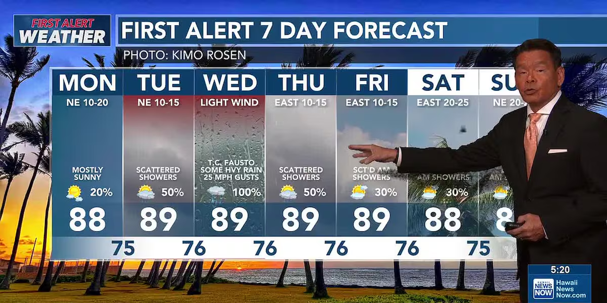
HONOLULU (HawaiiNewsNow) – Breezy trade winds will bring periods of showers to windward and mauka areas Monday as tropical cyclone Fausto nears the islands.
Read more La Hoihoi Ea celebrated in Honolulu ahead of holiday
Fausto is forecast to be a weakening tropical storm on a track that will take it just north of the state late Tuesday into Wednesday. If it stays on this track, we are not expecting any strong winds, but there could be some locally heavy rain, mainly on Wednesday. Winds are expected to be light Wednesday, but there could be occasional gusts near 25 miles per hour.
A drier and more stable trade wind pattern will return once Fausto moves away to the west-northwest on Thursday. Trades could become quite breezy going into the upcoming weekend.
View the latest weather conditions here.
While Fausto may not bring damaging winds and rain, it will generate large and dangerous waves along east-facing shores. A high surf advisory is in effect for east shores until 6 p.m. Wednesday. Waves are expected to reach 10 to 14 feet from east to west Monday, and there’s a chance waves could reach high surf warning levels. Waves will ease Thursday.
Read more New study explores reviving rice production in Hawaii
On other shores, north shores could get some waves as Fausto passes to the north. Surf on south and west shores will decline as the current south swell lowers.
Download the HNN Weather app from the Apple App Store or Google Play for the latest updates from your First Alert Weather Team: chief meteorologist Jennifer Robbins, meteorologist Drew Davis, and weather anchors Guy Hagi, Ben Gutierrez, and Billy V.








Post Comment