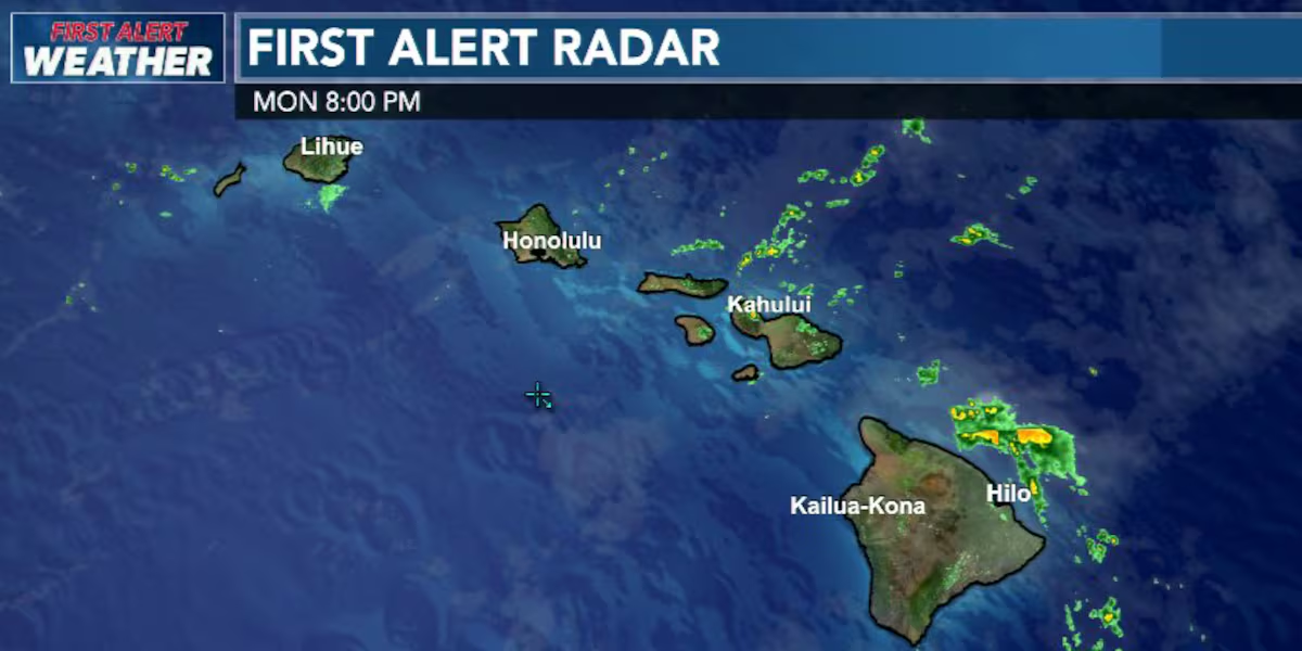
First Alert Forecast: Heavy Showers Just Offshore of Hamakua Coast
HONOLULU (HawaiiNewsNow) – A patch of moderate to heavy showers can be seen on radar just off the Hamakua Coast, windward Maui and Molokai. The National Weather Service short-term forecast update says they should stay offshore, but no guarantees. Another batch of showers looks to be bearing down on Hawaii Island’s southeast coastline.
Read more Police investigate after man found dead with suspicious injuries at Hilo park
We are anticipating stronger trade winds to start building tomorrow and for conditions to be breezy by tomorrow evening. The stronger trade winds will likely stay with us through the weekend.
Moisture from former tropical storm Norbert will dampen those trades starting late Wednesday to Friday morning… maybe into Saturday. Those showers will be steady, mainly windward and mauka, but will spread leeward at times.
Read more Travelers heed calls to avoid Kauai amid Hurricane Lowell recovery
Surf will come up on south shores tomorrow with another swell by Friday.
View the latest weather conditions here.
Download the HNN Weather app from the Apple App Store or Google Play for the latest updates from your First Alert Weather Team: chief meteorologist Jennifer Robbins and weather anchors Guy Hagi, Dan Cooke, Ben Gutierrez, and Billy V.
Read more Vendor applications now open for new Lahaina marketplace






Post Comment