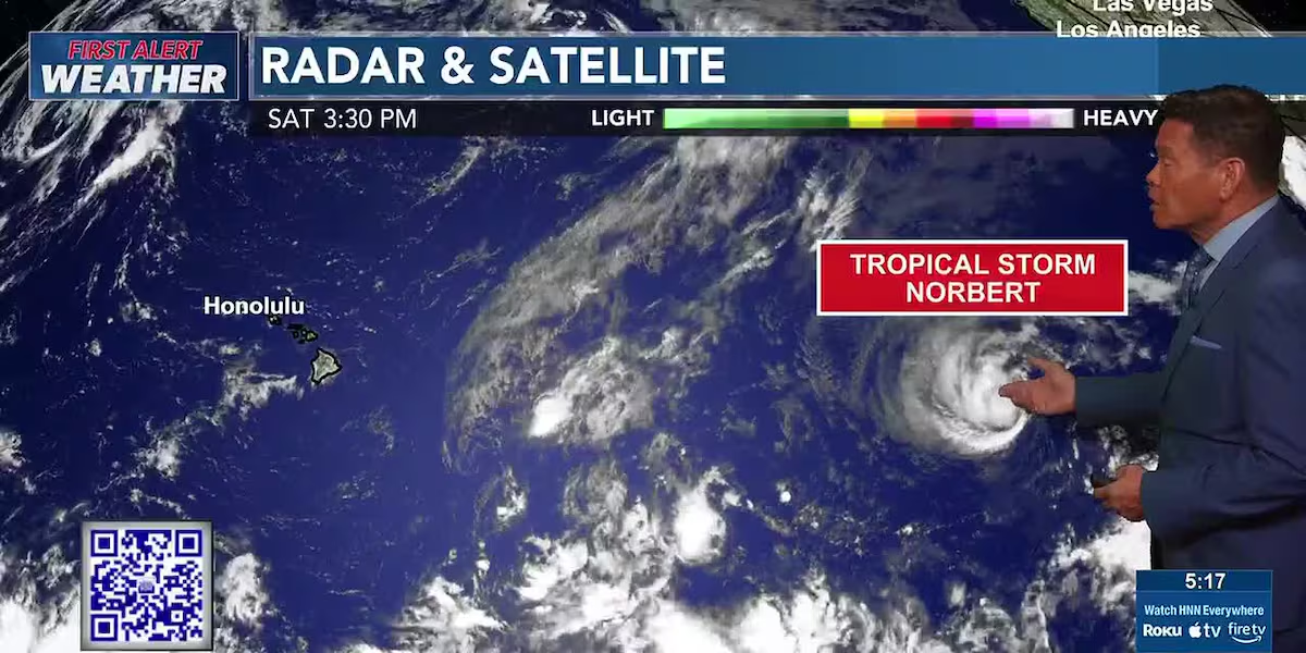
First Alert Forecast: Mostly dry trade winds ahead of Tropical Storm Norbert
HONOLULU (HawaiiNewsNow) – Mostly dry trade wind weather conditions will prevail, with only light windward showers through the first part of the coming week.
Read more Cut off by Hurricane Lowell, Kauai man worries about water for 60 cattle
A First Alert for some changes in the later part of the week, thanks to tropical cyclone Norbert. The current forecast calls for it to become a post-tropical low by Tuesday and pass to the south of the islands.
Trade winds will increase as the pressure gradient tightens around Norbert’s remnants, with rainfall and humidity increasing east to west from Wednesday night through Friday night.
The tropical moisture from Norbert will combine with a surface and upper trough, which could result in some flooding across the state. Stay tuned.
Read more Mid-Pacific unveils new $7.5M track and field facility
View the latest weather conditions here.
Surf along south-facing shores are declining with a facing swell. A moderate swell generated near New Zealand could give bump to south shore surf around mid to late week next week.
Elsewhere, surf along east-facing shores will remain small through the week, with an increase in the coming week with stronger trade winds and a swell generated by Norbert. North shore surf will remain tiny to flat.
Download the HNN Weather app from the Apple App Store or Google Play for the latest updates from your First Alert Weather Team: chief meteorologist Jennifer Robbins and weather anchors Guy Hagi, Dan Cooke, Ben Gutierrez, and Billy V.
Read more Hawaiian Airlines adds Kauai flights, carries relief supplies after Hurricane Lowell






Post Comment