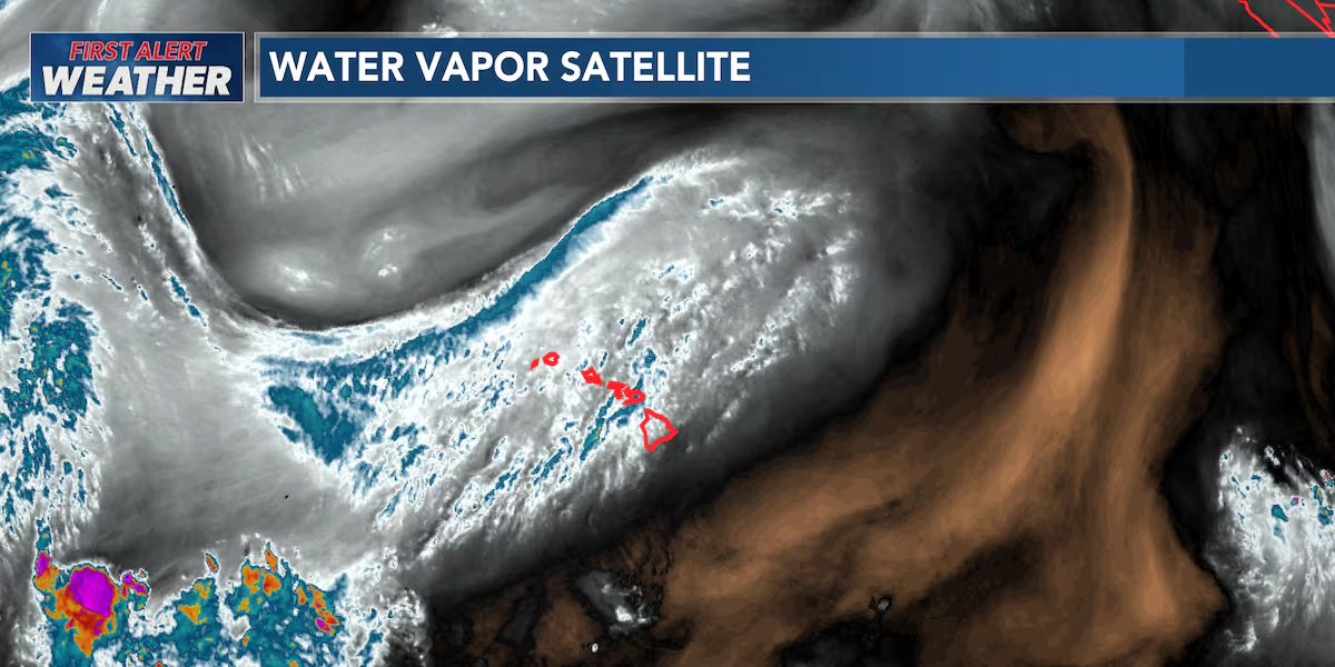
First Alert Forecast: No major first alerts with light to moderate trades
HONOLULU (HawaiiNewsNow) – Tracking mid to high level clouds sweeping in from the south and then low-lying clouds over mauka.
Read more Naked man arrested for murder after fatal beating at West Maui condo-resort
Trade winds will stay on the lighter side through Friday before picking up again this weekend. With the lighter winds, we’ll continue to see afternoon clouds and a few showers develop over interior and leeward areas, especially on Kauai and Oahu where an upper-level low is adding a little extra instability to the atmosphere.
Windward and mountain areas will still see passing trade wind showers, but the western half of the state has the best chance for a few enhanced showers over the next couple of days. As the upper-level system moves away on Friday, our weather should become a bit more stable.
Light to moderate trade winds will continue through the rest of the week before strengthening over the weekend. The lighter winds mean afternoon sea breezes can develop, especially in sheltered leeward areas, leading to localized cloud buildups and a few afternoon showers.
An upper-level low just northwest of the islands is creating SLIGHT instability over the western end of the state through Thursday. That means Kauai and Oahu have the best chance for more pop up showers, particularly during the afternoons and overnight into Thursday morning. A few showers could be briefly heavy, but widespread flooding isn’t expected.
Read more Small delegation, big ideas: Hawaii takes lead at national policy conference
By Friday, the upper low lifts north, allowing the atmosphere to become more stable.
The remnants of former Tropical Cyclone Genevieve continue to disrupt the normal trade wind pattern by weakening the high pressure north of Hawaii. As a result, trades stay on the lighter side through Friday before strengthening back to locally breezy levels this weekend as high pressure rebuilds.Looking ahead to the weekend, forecasters continue to monitor a plume of tropical moisture expected to pass near the eastern end of the island chain. Current guidance keeps the deepest moisture mainly south of Hawaii, but enough could become wrapped into the trade winds to bring an increase in showers to Maui and the Big Island from late Saturday into Sunday. Oahu and Kauai are expected to be less affected by this tropical moisture.
View the latest weather conditions here.
Download the HNN Weather app from the Apple App Store or Google Play for the latest updates from your First Alert Weather Team: chief meteorologist Jennifer Robbins, meteorologist Drew Davis, and weather anchors Guy Hagi, Ben Gutierrez, and Billy V.
Read more Maui police arrest Wailuku man after barricade incident





Post Comment