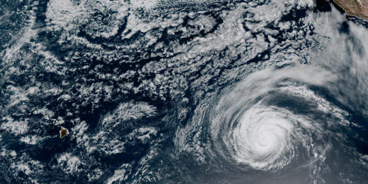
Hurricane Fausto moving westward on track toward Hawaii
HONOLULU (HawaiiNewsNow) – Hurricane Fausto is moving westward in the central North Pacific on a track that will take it close to Hawaii early next week.
Read more Former Kauai resident indicted on fentanyl trafficking charge
The National Hurricane Center said in data valid at 5 p.m. Friday, Fausto was 1,385 miles east of Hilo and was moving west at 14 miles per hour.
The hurricane had maximum sustained winds of 105 miles per hour. Hurricane force winds extend up to 45 miles from the center, with tropical storm force winds extending up to 205 miles.
The current forecast track has Fausto tracking just north of the islands sometime Tuesday into Wednesday. It is expected to be a tropical storm by that time, and could even be a remnant low.
Fausto likely has peaked in intensity. The tropical cyclone is moving into an area of drier air and slightly cooler ocean waters, and it should gradually weaken over the next few days.
Read more Police arrest suspect after Kalihi vehicle theft ends in crash
Track storms and prepare with the HNN First Alert Hurricane Center
By Monday, Fausto will run into increasing wind shear from the southwest that will increase the rate of weakening. The system will also become less symmetrical, with the strongest winds and heaviest rain in its northern half. If the forecast holds, those winds and rain should remain north of Hawaii.
Large ocean swells generated by Fausto could also produce dangerous waves for east-facing shores by Sunday.
All that said, you should still be prepared for a higher risk of some impacts from wind and rainfall. It’s still too early to say exactly what areas will be impacted, or how strong those impacts will be.
Read more Maui Raiders fan gets surprise of a lifetime for 40th birthday









Post Comment