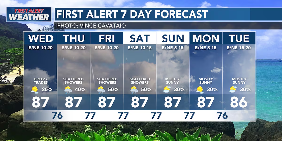
First Alert Forecast: Increased chance for showers starting Thursday
HONOLULU (HawaiiNewsNow) – Moderate to breezy trade winds will persist over the next week. Some wind gusts could reach 25-30 miles per hour, especially in valleys or downwind of the mountains.
Read more OHA trustees clash over CEO lawsuit, minority trustees back full damages
Rainfall chances over the next 48 hours continue to be the highest over windward Hawaii Island and windward Maui.
We are expecting an increased chance of showers starting Thursday night that continues into the weekend. With the trade winds persisting, rainfall will continue to be focused over the mountains and on windward slopes. Some downpours are expected.
Read more Spotlight Now: Cultural stewardship on Hawaii Island
The current S/SW swell will be dropping through Thursday. Another moderate south swell is due on Sunday. Surf along east-facing shores will remain rough and choppy through the week.
View the latest weather conditions here.
Download the HNN Weather app from the Apple App Store or Google Play for the latest updates from your First Alert Weather Team: chief meteorologist Jennifer Robbins, meteorologist Drew Davis, and weather anchors Guy Hagi, Ben Gutierrez, and Billy V.








Post Comment