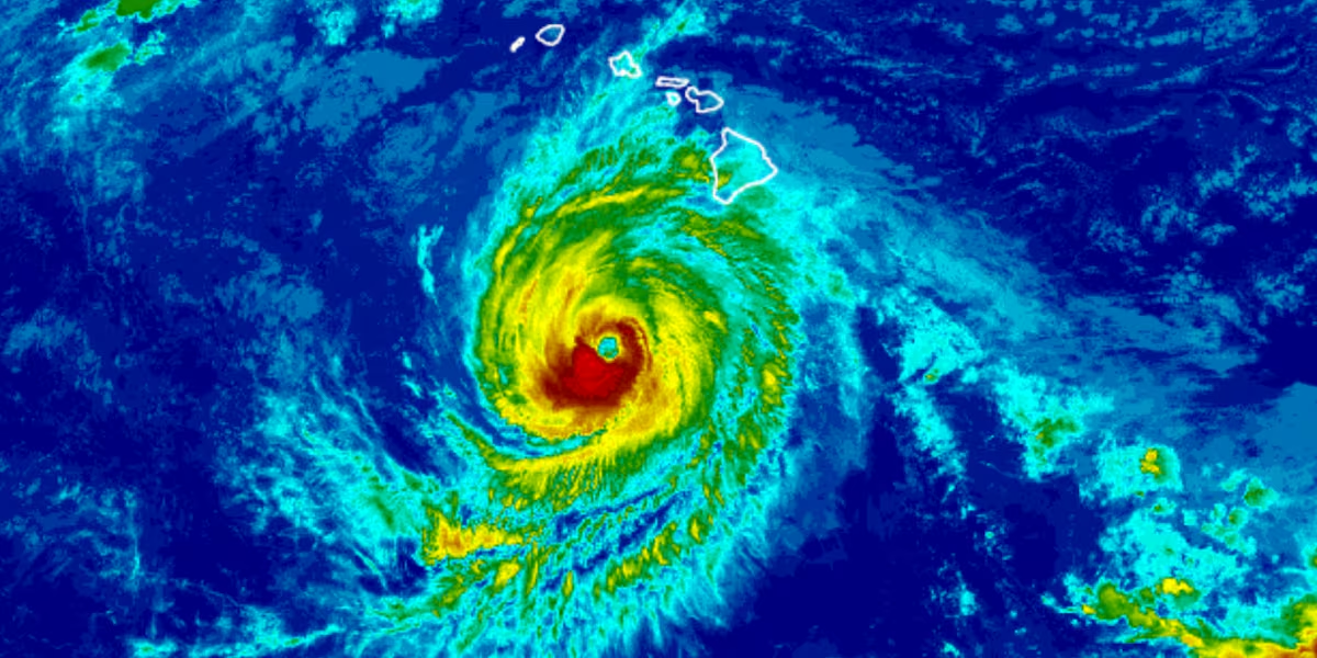
Hurricane Nolo strengthening as it moves west; gusty winds, rain, waves still a threat
HONOLULU (HawaiiNewsNow) – Hurricane Nolo is starting to move faster toward the west on a path taking it well south of the Hawaiian Islands.
Read more 1 dead after shooting in Kailua Target parking lot
The National Hurricane Center said at 11 p.m. Saturday, Nolo’s maximum sustained winds increased to 100 miles per hour. It is forecast to strengthen into a major hurricane Sunday or Sunday night and peak on Monday before steadily weakening.
Hurricane force winds extend up to 35 miles from the center, while tropical storm force winds extend outward up to 150 miles.
Nolo is about 200 miles south-southwest of South Point, or 335 miles south of Honolulu. It was moving west at 9 miles per hour.
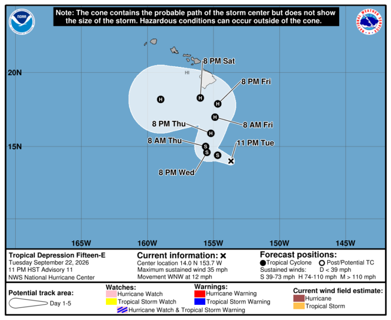
The hurricane remains in an area with very warm sea surface temperatures and abundant moisture which will cause rapid intensification.
Potential threats
WIND: Strong and gusty winds are possible for all of the Hawaiian Islands through the weekend, even though the core of the system will remain well to the south.
RAIN: For the eastern and southern portions of the Big Island, Nolo will produce additional rainfall totals 1 to 2 inches with isolated maximum totals of 4 inches, bringing storm totals to 10 to 15 inches with maximum amounts of 20 inches. Additional areas of flooding and mudslides are still possible, especially in areas of steep terrain.
For the western portions of Hawaii Island, rainfall totals of 1 inch or less is expected. For eastern Maui, additional rainfall totals of 1 to 2 inches are expected, bringing storm totals to 4 to 8 inches. Additional flooding and mudslides are possible, especially in areas of high terrain.
STORM SURGE: The threat of a significant storm surge has diminished, but water levels will remain elevated due to persistent wave action.
Read more Rainbow Wahine sweep series with New Mexico, starts conference run, 2-0
SURF: Swells generated by Nolo are affecting exposed east- and south-facing shores of Hawaii Island and are expected to spread westward and build through the weekend. These swells are likely to cause life-threatening surf and rip current conditions.
Weather Alerts
A High Wind Warning is in effect until 6 p.m. Sunday for portions of Maui County and Hawaii Island. East winds 30 to 45 mph with gusts up to 75 mph will be possible downwind and over higher terrain, especially for Maui and Kohala.
A Wind Advisory is in effect until 6 p.m. Sunday for portions of all islands. East winds of 25 to 35 miles per hour with gusts near 55 miles per hour will be possible.
A Flood Watch remains in effect for Hawaii Island until 6 a.m. Sunday.
A High Surf Warning is now in effect for the southeast shores of Hawaii Island, including the Kau and Puna districts. Dangerously large waves of 12 to 16 feet are expected.
A High Surf Advisory is in effect for the east and southeast shores of Molokai and Maui, and the east shores of Kauai and Oahu.
Remain prepared
Even as the most catastrophic effects from Nolo may be over, you need to remain prepared for this extremely active hurricane season.
Related posts
View the latest weather conditions here.
Download the HNN Weather app from the Apple App Store or Google Play for the latest updates from your First Alert Weather Team: chief meteorologist Jennifer Robbins and weather anchors Guy Hagi, Dan Cooke, Ben Gutierrez, and Billy V.
Read more Kauai’s trail to Hideaways Beach reopens after months of repairs







Post Comment