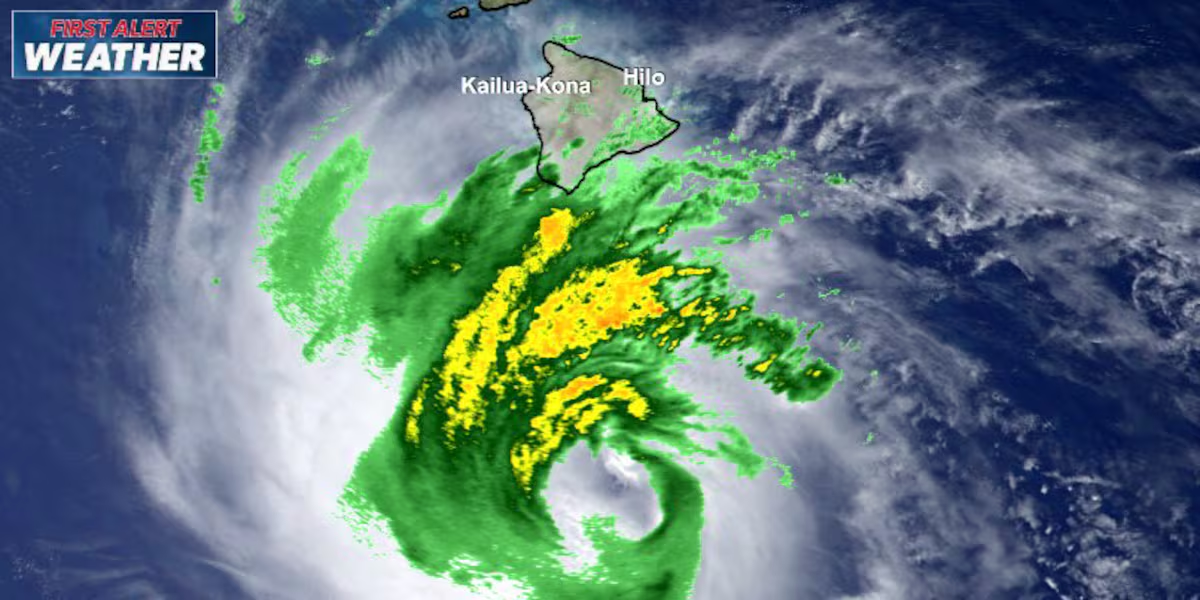
First Alert Forecast: Nolo’s eye remains south but gusty winds and squalls possible
HONOLULU (HawaiiNewsNow) – Hurricane Nolo is nearly stationary tonight south of the Big Island, with the storm holding at 105 mph, making it a Category 2 hurricane.
Read more High winds close 20-mile stretch of road in North Kohala
Nolo was located about 150 miles southeast of South Point and 350 miles south-southeast of Honolulu as of 8 PM Friday.
The central pressure is down to 975 millibars.
The big change tonight: Nolo has essentially stopped moving. We are expecting it to begin moving westward with increasing forward speed Saturday and Sunday. The forecast track keeps the center well south of the main Hawaiian Islands, but the storm is expected to strengthen into a major hurricane this weekend, with additional strengthening possible early next week.
WHAT THIS MEANS FOR HAWAIʻI Big Island: This remains the biggest concern. Tropical-storm conditions are already occurring in some areas, especially over higher terrain, and hurricane conditions are possible as early as Saturday.
Rainfall will be especially dangerous across eastern and southern Hawaiʻi Island, with 8 to 12 inches expected and isolated totals up to 16 inches. That could trigger life-threatening flooding and mudslides, particularly in steep terrain.
Western Big Island could see 1–3 inches, with locally up to 6 inches.
Maui County: A Tropical Storm Watch remains in effect. Eastern Maui could receive 4–6 inches, with locally up to 8 inches, bringing the potential for life-threatening flooding and mudslides.
Oʻahu and Kauaʻi: The current forecast calls for generally 1–2 inches of rain, but strong and gusty winds are possible across all of the Hawaiian Islands through the weekend.
Read more Rainbow Wahine open Mountain West play with sweep over New Mexico
WIND & SURGE Hurricane-force winds extend 45 miles from Nolo’s center, while tropical-storm-force winds extend out 140 miles.
A 1–3 foot storm surge is possible along the Hawaii County coast, especially if peak surge coincides with high tide.
And surf will be a major concern. Swells are already reaching exposed east- and south-facing shores of the Big Island and will spread westward and build through the weekend, creating life-threatening surf and rip-current conditions.
Nolo’s center is staying south of Hawaiʻi, but the storm is strengthening while barely moving. The combination of increasing wind, very heavy rain, dangerous surf and the potential for hurricane conditions makes Saturday a critical day for the Big Island and Maui County.
View the latest weather conditions here.
Download the HNN Weather app from the Apple App Store or Google Play for the latest updates from your First Alert Weather Team: chief meteorologist Jennifer Robbins and weather anchors Guy Hagi, Dan Cooke, Ben Gutierrez, and Billy V.
Read more Aloha Festivals Floral Parade proceeds Saturday on Oahu despite Hurricane Noel







Post Comment