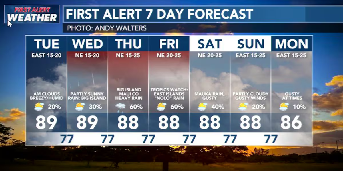
First Alert Forecast: Wet Weather Mid-Week
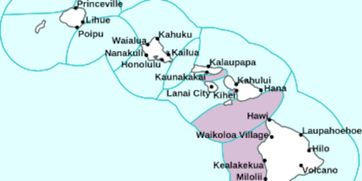
HONOLULU (HawaiiNewsNow) – What used to be tropical depression 15-E is showing signs of organization as it approaches the islands from the southeast. The forecast models are all over the place with the system’s path, intensity and timeline. But it’s a very good idea to be getting ready for some strong winds and wet weather, particularly if you are on Hawaii Island or anywhere in Maui County. The easter half of the island chain is expected to get the worst of Nolo. That’s the next name on the list for storms formed in the Central Pacific.
Read more Live opossum captured at Honolulu Harbor
Winds could gust to 70 mph on Big Island summits. Haleakala is forecast to see winds greater than 60 mph. The wind forecast could change dramatically in the next day or two.
Rainfall amounts expected range widely depending on the forecast source… anywhere from inches a day to multiple feet of rain over a three-day period.
We will know more once Nolo has formed. By knowing the starting point of the system, the National Hurricane Center can better understand the dynamics and provide a more confident forecast.
Read more What it takes to be the Aloha Festivals’ pau queen
In the meantime, expect breezy trade wind weather with a few showers and mostly bearable humidity levels.
Surf is on its way down along East, South, and West-facing shores. A northwest swell from the typhoon currently brushing Japan is expected Friday.
View the latest weather conditions here.
Download the HNN Weather app from the Apple App Store or Google Play for the latest updates from your First Alert Weather Team: chief meteorologist Jennifer Robbins and weather anchors Guy Hagi, Dan Cooke, Ben Gutierrez, and Billy V.
Read more Lifeguard revives unresponsive man at Maili Beach Park





Post Comment