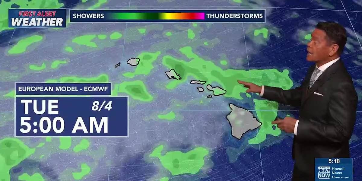
First Alert Forecast: Trade winds to ease with more showers possible midweek
HONOLULU (HawaiiNewsNow) – Trade winds will become less breezy as public school students head back to class this week. Forecast models hint at enhanced windward and mauka showers for the western end of the state Tuesday through Thursday.
Read more ‘Hale Koa hates Hawaiians!’ Protesters say hotel is misusing their culture
Winds will become lighter through much of the week what’s left of former tropical cyclone Genevieve passes far to the north and east, disrupting the trade wind flow.
View the latest weather conditions here.
Surf will be rather small to start the week, with only small background swells for south-facing shores. rough and choppy waves generated by Genevieve will linger on east shores. North and west shore waves will be tiny to flat for the next several days.
Read more UH researchers use drones to tag humpback whales
Download the HNN Weather app from the Apple App Store or Google Play for the latest updates from your First Alert Weather Team: chief meteorologist Jennifer Robbins and weather anchors Guy Hagi, Ben Gutierrez, and Billy V.
Read more HECO ends power shutoff watch as fire risk conditions ease





Post Comment