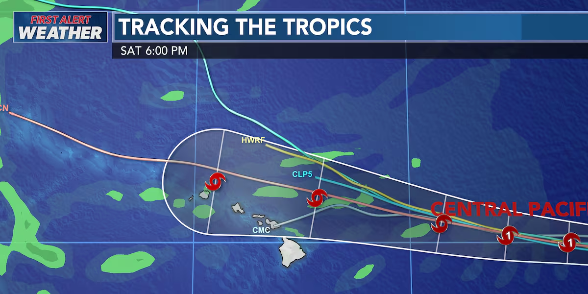
First Alert Forecast: Fausto is moving towards the Central Pacific
HONOLULU (HawaiiNewsNow) – We have a number of first alert with the big Surf today with the hurricane swell, coming our way and of course tracking Fausto and also the potential of episode 52…. Whew!
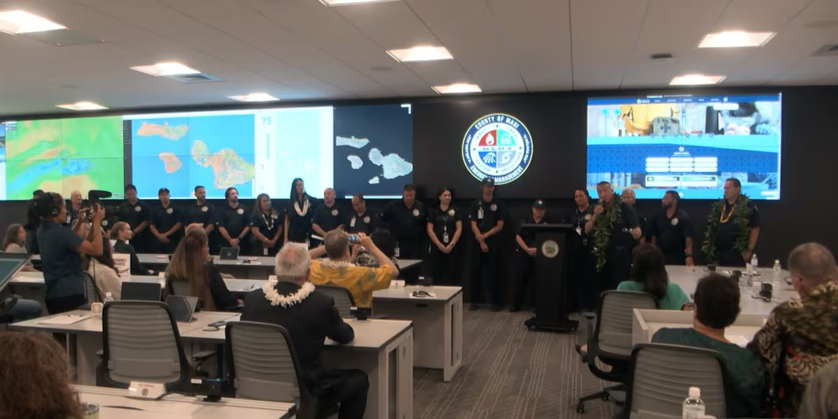
Read more Maui County blesses new Emergency Operations Center ahead of wildfire anniversary
A beautiful stretch of classic Hawaiʻi weather is ahead for the weekend. Breezy trade winds will continue to keep temperatures comfortable while bringing passing clouds and showers mainly to our windward and mauka communities. Most leeward areas will stay mostly sunny with just an isolated passing shower.
At the beaches, we’re watching two different surf stories. The current south swell is gradually easing today, but another pulse of south-southwest swell arrives Saturday and peaks through Sunday.
That means south-facing shores could once again see advisory-level surf this weekend with strong currents at the more exposed beaches.
We’ll also begin to see the first signs of Hurricane Fausto’s long-period swell arrive late Saturday. East shore surf will gradually build Sunday, continue increasing Monday, and is expected to peak Tuesday into Wednesday. Depending on Fausto’s final track and strength, east-facing shores could see advisory-level surf along with rough ocean conditions and stronger currents.
Out in the Pacific, Hurricane Fausto remains a Category 2 hurricane, but it’s beginning to weaken as dry air disrupts the storm’s core. As it continues westward toward the Central Pacific, it will move over slightly cooler waters and into stronger upper-level winds, which should steadily weaken the system over the next several days.
Right now, the forecast continues to bring Fausto into the vicinity of Hawaiʻi during the Tuesday through Wednesday time frame.
By then, it’s expected to be a tropical storm, or possibly even the remnants of a tropical cyclone. While the storm should be much weaker than it is today, we’re still expecting the potential for impacts across parts of the state.
Read more Maui teen claims 4th national title at USA Boxing Junior Olympics
The biggest questions now are exactly how far north or south the storm tracks and how much strength it can hold onto as it approaches.
Those answers will determine where the strongest winds and heaviest rain set up. Even if the center stays north of the islands, we’ll likely see increasing trade winds, bands of tropical moisture capable of producing periods of heavy rain, rough seas, and large surf, especially along east-facing shores.
So, while there’s no reason to panic, this is a good time to stay weather aware.
We’ll continue refining the forecast over the weekend as confidence in Fausto’s track and impacts continues to improve.
One other thing we’ll be watching this weekend is Kīlauea. Based on the recent eruptive pattern, there’s a potential window for Episode 52 sometime this weekend.
As always, volcanic activity can change quickly, so we’ll keep a close eye on it and bring you updates if a new eruptive episode begins.
View the latest weather conditions here.
Download the HNN Weather app from the Apple App Store or Google Play for the latest updates from your First Alert Weather Team: chief meteorologist Jennifer Robbins, meteorologist Drew Davis, and weather anchors Guy Hagi, Ben Gutierrez, and Billy V.
Read more Truck bed riding age raised to 16 as Hawaii enacts new traffic safety laws






Post Comment